A Lidar 101 for the Civil Engineer

The development of smart technologies, whether for the home, car, or city, relies on the ability of the system to gather good information. A rule of thumb in software design is “Garbage In, Garbage Out”—if you’re relying on bad data, you cannot possibly get good results. Fortunately, sensor technology is developing as quickly as the computational infrastructure that uses it. A variety of different sensors are available to the smart city engineer.
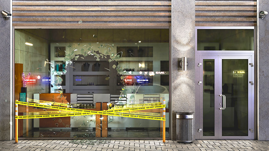
Lidar is a big mover and shaker in the world of sensing input technologies. Its famous for its use in automotive spaces as the main sensor of self-driving cars. However, not all lidar is the same.
Like the sense organs of animals, how sensors are adapted depends on the niche in which they are meant to work. In the animal kingdom, the placement and number of eyes, or the placement of scent organs, depend on where the animal fits into the ecosystem. Lidar sensors are also rapidly evolving for specific uses. Whether the sensor is on land or in the sky, whether it’s moving or stationary, and in what atmospheric conditions it must work all change how the sensor technology is engineered.
What is lidar?
Lidar stands for “Light Detection and Ranging.” It is an active remote sensing technology, meaning it sends out pulses of energy, and then reads the reflected return of that energy, to gather information about the world around it. In this way, it works like echolocation, ultrasound, or radar: but with lidar, it is a laser low frequency light beam that is used to scan the world around it.
A lidar sensor is like a person with a flashlight in a dark room, strobing the light on and off. Reflected light would allow the human with the flashlight to see. However, the lidar sensor gets more information than the human can. The sensor can time how long the light takes to return from every point it touches. This measurement provides the distance to each point it “sees”. This is known as the “time-of-flight” calculation.
A time-of-flight calculation on each point allows lidar to create a point cloud mapping three-dimensional space, rather than just creating a two-dimensional image from the light, as might be captured by a camera.

The reflectivity of each point the beam touches matters to the creation of the point cloud. White or reflective objects return more data to the lidar than darker objects, and can generally be seen from farther away.
Lidar design
Lidar sensors are, at the most basic, made of a laser, a light detector, and a processor that controls the process of sending and receiving light.
The processor uses a field-effect transistor (MOSFET/power FET) to transmit light through a laser diode—a device that creates light when given electricity. It receives information through a photodiode, which receives light and creates electricity. The processor must be smart enough to ignore background “noise” and only interpret a strong signal. When the reflection of the laser’s pulse is too weak to stand out from the background, the object becomes invisible.
Different lidar sensors may use different frequencies of light depending on their application. Green-light frequencies (often 532 nm) are better at penetrating water: these might be used by a drone to ascertain the topography of a creek bed or lake. Lidar sensors looking for precise information about objects usually use near-infrared. Near infrared wavelengths depend on the application: 1064 nm is common and commercially available, often used in planes and drones. Cars may use a different near-infrared frequency like 950nm.

Lidar may be engineered as a solid state or mechanical technology. Mechanical lidar spins for a full field of view. Like an incredibly fast-moving radar sweep, the lidar transmitter and receiver rotate on a stage and build a flash-bulb image of their field of view. Mechanical, spinning lidar can be built and housed to have a limited range of vision out the front of the lidar case, or it can have a 360-degree field of vision, if the rotating platform is built into a cylinder with processor above or below the emitter and sensor.
Mechanical lidar, with moving parts and design requirements, is often not the first choice for automotive applications. Mechanical failure due to a moving part breaking could be deadly on the road. Shifts in acceleration are common and cause mechanical strain. Additionally, automotive applications often need lidar to fit within vehicle design, and 360-degree cylindrical options provide too much complication for no real additional safety or operational benefit.
Solid state lidar works without spinning. Instead, the beam or beam array is tuned to do the work once done by rotational movements. Movement may still be required, just on a much smaller scale. This allows for miniaturization—and the inclusion of lidar into iPhones and other small devices.
One approach with solid state lidar is to utilize MEM Systems. MEMS stands for microelectromechanical systems and refers to a class of micro-machines that show up in many technological innovations. In lidar, MEMS devices are used to adjust small mirrors within an array, to move the unit’s laser light. These MEMS systems are also evolving as new niches are found. The original MEMS lidar often used millimeter sized mirrors, but these small sizes mean a slim beam and a limit to the working range. Innovators in the field, like Blickfeld, are working on solutions to push the functional range for MEMS. Blickfeld’s solution is a stable system with larger mirrors that are able to achieve longer ranges. New ways of moving the mirrors are also being developed to provide a greater range of motion (and field of vision) to these “solid-state” solutions.
A similar solid-state system takes the standard laser beam or beam array and directs it by shifting a liquid-crystal metasurface (LCM). Optical phased arrays (OPAs) approach the problem in a different way, by putting a group of optical antennae together and running them in patterns that allow the system to create a steerable beam.

Types of lidar—airborne or terrestrial
Lidar is sometimes categorized by whether it’s airborne or terrestrial.
Since a point cloud contains the distance to sensed objects, lidar is an effective technology for creating topographies using a bird’s eye view. In these applications, sensors are placed on an aircraft and flown over a surface, capturing both landforms and objects upon the ground. Mechanical lidar is often sufficient to work in cruising altitude conditions. Where once creating topological maps required surveying and best-fit, lidar can do millions of measurements from which to construct a map. It offers a higher degree of accuracy, especially in remote areas, than models built from the ground. Data models using reflectivity patterns in the area can separate landmass from vegetation, animals, and built objects.
Bathymetric lidar is used for mixed land-and-water topography, typically combining both near-infrared and green light lasers. Land and shoreline details (and possibly water-surface level data) are gathered with the near-infrared. Green light picks out detail from beneath the water.
Airborne lidar measures greater distances to points than does terrestrial lidar. This measuring at long distances means solving a different set of issues than need be solved for closer objects. Higher peak powers are needed from 2000 meters than from 1000 meters. Additionally, light experiences beam divergence—the beam diameter expands as the distance increases from the aperture of the light. This beam divergence varies based on both the laser and the power being put through it. The spread of light from the beam will change the precision of the system at different focal lengths. Specific sensors will therefore offer different optimal focal lengths. Precision at longer distances will generally mean higher peak power or lower resolution.
Customization is available with many lidar systems. The engineer decides the optimal resolution to capture data without overengineering? A lower resolution, with lower power or smaller apertures, may be sufficient. Complex lidar systems often use several types of lidar which allows customization to be site and application specific.
Aerial sensors, optimized for these issues, may therefore also be maladapted to seeing close objects. On top of all these issues, precision in commercial aircraft applications often also relies on GPS information about the plane’s orientation to the landscape. When the plane turns fractionally, the lidar will compensate.
Terrestrial lidar is generally more interested in objects than topography and therefore has a different set of problems to solve.
On land, there are two overall categories of lidar. They fall into one of two categories: moving applications, like those placed in vehicles, and stationary applications. Moving applications often use solid-state systems. Stationary applications may choose solid-state, but depending on application can choose mechanical lidar, including those units with 360 degrees of view.

Lidar solutions for the smart city
What do all these niched sensor options mean for the city engineer looking for the right sensor to solve a problem? Lidar is expensive and the different options can be confusing. Choosing the right sensor is necessary to get the right information for a particular application.
In most (but not all) cases, Smart City sensors will be terrestrial and stationary. Making this determination can limit the number of options, but with lidar fast evolving, there are still many to choose from. Sorting through available sensors gets more complex as the hardware manufacturers innovate and evolve for particular niches. There may be sensors made for a similar problem to the one you’re solving that are best fit for your application.
Reliance Foundry is creating a smart cities line called CitySage to help with data acquisition and analysis. If you need eyes in the field, we’re there to help retrieve and analyze the data. We are working with cities to innovate solutions for unique problems, like waste and water level monitoring, loitering detection, and traffic analysis. In doing so, we are building up a knowledge base of which sensors are best in each niche.
Using this expertise, we creatively address the issues that challenge our clients. We’ll pick the right sensor and place it in the right place, analyze the data, and create programs that will respond with alerts, data, or actions to help cities manage their resources. Our solution starts with field monitoring with IoT (internet-of-things) site furnishings. The data from these sites is uploaded to our cloud for storage and processing. Our data scientists then help create machine learning systems to provide analysis specific to that site’s needs. We construct dashboards for city managers to see all deployments at-a-glance. Alerts can be sent to email or phone, as well as popping up in the dashboard.
Have a problem you’d like help to solve? Contact us to set up a consultation.

Join our Newsletter!
Receive updates via Reliance Foundry’s newsletter. You may unsubscribe at any time.